
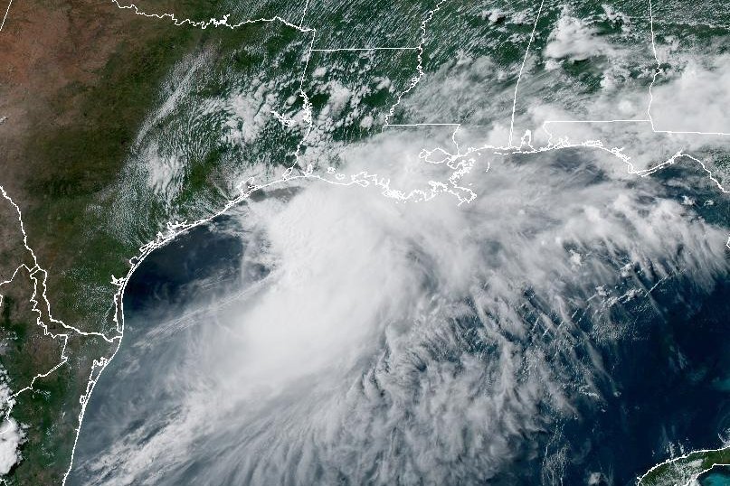
Tropical Storm Arthur may cause dangerous flooding in parts of the southeastern United States throughout Wednesday and into Thursday. Image courtesy of NOAA.
June 17 (UPI) — Potentially dangerous flooding is expected across portions of the southeastern United States as a result of Tropical Storm Arthur, the National Hurricane Center said Wednesday.
The first named storm of the Atlantic hurricane season formed along the Texas coast earlier in the day.
The eye of the storm was about 20 miles north-northwest of Matagorda, Texas, and 195 miles west-southwest of Lake Charles, La., the NHC said in its 4 p.m. CDT update.
The storm had maximum sustained winds of 45 mph — the same as in the NHC’s 1 p.m. update — and was moving north-northeast at 7 mph.
There was a tropical storm warning in effect from Sargent, Texas, to Morgan City, La.
“On the forecast track, the center of Arthur should move farther inland over southeastern Texas tonight,” the NHC said.
The storm is expected to weaken as it moves inland, and it could dissipate by Wednesday night or early Thursday. Rainfall totals of 5 to 10 inches were expected, with totals up to 20 inches in isolated areas, through early Friday from the mid and upper Texas coast, into southern and central Louisiana, Mississippi and Alabama and the western parts of Georgia and the Florida Panhandle.
“This could generate dangerous to life-threatening flash flooding,” the NHC said.
Tropical storm-force winds were expected in the warning area into Wednesday night. A storm surge of 1 to 3 feet could affect areas from Matagorda, Texas, to the mouth of the Mississippi River.
Swells generated by the storm are likely cause life-threatening surf and rip current conditions across the northwestern Gulf Coast for the next few days. Tornadoes are possible late tonight across southeast Louisiana and southern Mississippi and tomorrow into parts of Alabama, Georgia and the Florida Panhandle.