
Ex-Tropical Cyclone Narelle was downgraded to a tropical low on Saturday morning after making landfall in Western Australia on Friday.
Storm-ravaged communities were warned not to let their guard down, however, as residents along the state’s coastline prepared to assess the trail of damage along the Pilbara and North West Cape.
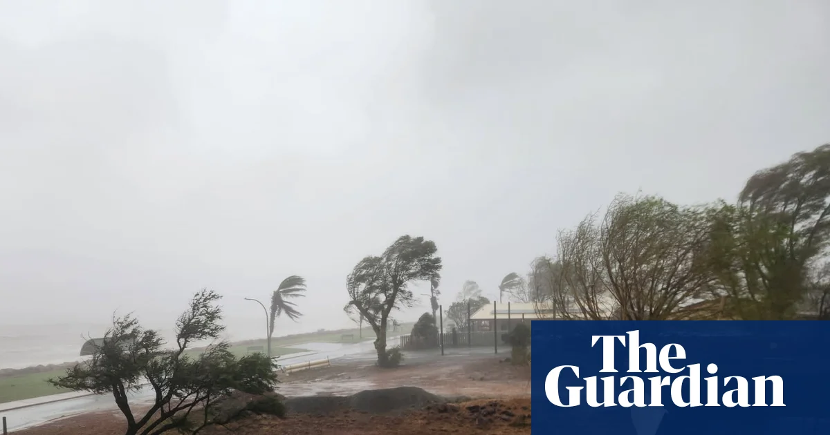
The system continued to lose intensity as it swept south-east on Saturday, bringing gusts of up to 100km/h and heavy rainfall. Flash flooding threatened the wheatbelt region and Perth.
The system was expected to continue moving southeast from Geraldton before likely exiting the south coast later on Saturday, with conditions expected to ease into Sunday, the Bureau of Meteorology said.
The BoM confirmed on Saturday morning at 5.45am local time that the system had a “very low” chance of redeveloping, but warned that the danger was not over for inland and southern districts.
Despite Narelle being downgraded, a “really powerful weather system” would continue to lash central and southern WA through Saturday night, said Angus Hines, a senior meteorologist at the bureau.
The BoM forecast significant rainfalls for the Gascoyne, central west and the wheatbelt throughout Saturday. Hines said cumulative rainfall was likely to trigger flooding across eastern and central regions, with a further 30mm to 70mm expected on Saturday.
“We could still see some strong wind gusts up to about 100km/h,” he said, “definitely enough to cause some damage … a few roofs or fences, bring down branches and cause power outages.”
Emergency warnings were downgraded across the state by late Saturday morning. Isolated watch and act warnings remained in place for parts of Perth, the midwest and Gascoyne and west of Onslow to Coral Bay. Locals were warned that a possible threat remained to lives and homes, and were told to stay away from damaged buildings.
The prime minister, Anthony Albanese, praised the efforts of emergency workers on Saturday and said the federal government “stands ready to assist” with the recovery.
“Our thoughts are with everyone in Western Australia at the moment, but also those who are continuing to be impacted in the Northern Territory and Queensland,” he said.
On Friday, Narelle had tracked south to Coral Bay and made landfall just south of the town before weakening to a category three system. It then passed east of Carnarvon on Friday afternoon, continuing to lose strength as it moved inland.
Carnarvon’s shire president, Eddie Smith, described a “thick, pink dust storm” that blanketed the town for two hours as wind gusts topped 100km/h.
Overnight, gusts reached 133km/h at Carnarvon airport and 122km/h at Gascoyne Junction, while widespread rainfall totals of 70 to 100mm were recorded across the Gascoyne region.
The holiday town of Exmouth, 1,250km north of Perth, bore the brunt of the storm when it was a category four system. Winds exceeding 250km/h tore roofs from buildings and caused widespread flooding. In a dramatic scene on Friday, 50 people were forced to flee the town’s primary evacuation centre after the building itself sustained wind damage.
The Department of Fire and Emergency Services (DFES) commissioner, Darren Klemm, said the damage was expected to be “significant” and emergency services would continue working with local councils to assess what support they needed.
The federal emergency management minister, Kristy McBain, told ABC on Saturday morning that there had been “extensive power outages across Exmouth and Carnarvon in particular”, estimating roughly 2,000 homes remained without power.
“We do know the system is weakening, but there is still significant wind gusts and heavy rain that it is bringing.”
Evacuation centres were open at Carnarvon PCYC, Shark Bay Recreation Centre, Activewest Stadium in Wonthella, Beechboro Community Hub and Ningaloo Function Centre in Exmouth.